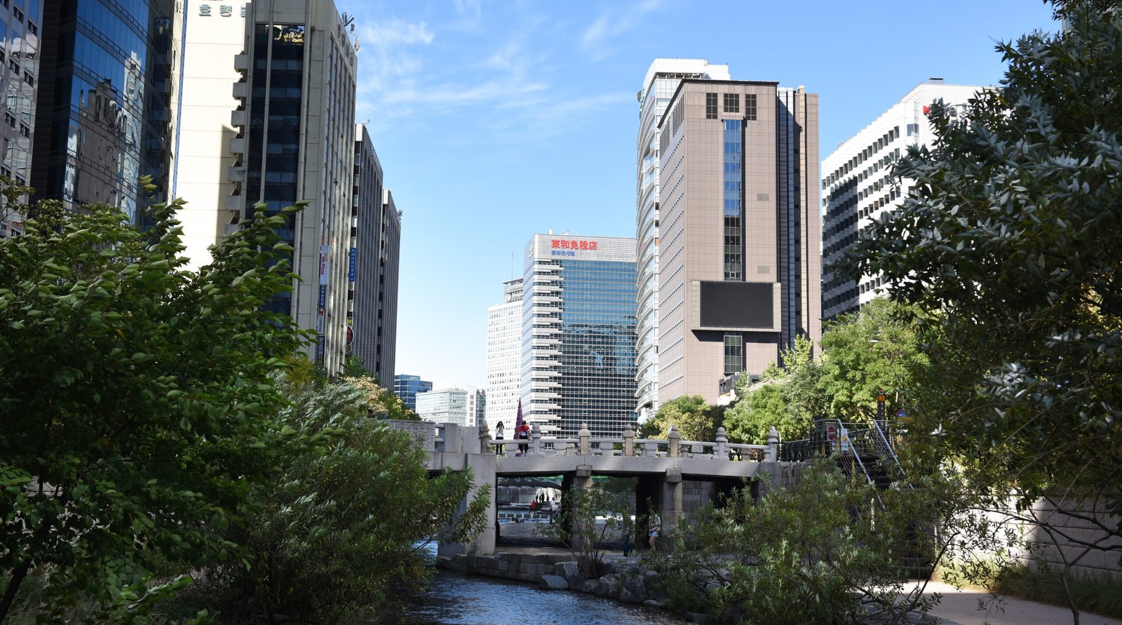
Cheonggyecheon Explained: The Stream Seoul Keeps Reinventing
Cheonggyecheon isn’t really a place you plan an entire day around. It’s more the kind of walk you fold into a day that’s already taking you through Gwanghwamun, Jongno, Euljiro, or Dongdaemun.
Start at Cheonggye Plaza and head east toward Gwangjang Market, and about an hour at an easy pace is plenty. The stream gets more atmospheric toward dusk, especially once the lights come on.
If you’re still figuring out how to move between these parts of the city, see our guide to getting around Seoul by subway, bus, taxi and T-money.
But the walk itself isn’t the most interesting thing about Cheonggyecheon.
The water isn’t just flowing there
The water you see in Cheonggyecheon today doesn’t simply arrive there naturally.
The Seoul Facilities Corporation’s official Cheonggyecheon overview lists 40,000 tons a day of treated Han River water, with capacity to supply up to 120,000 tons when needed. Groundwater collected from subway and other underground facilities also flows into the stream.
Even the water level itself is actively managed.
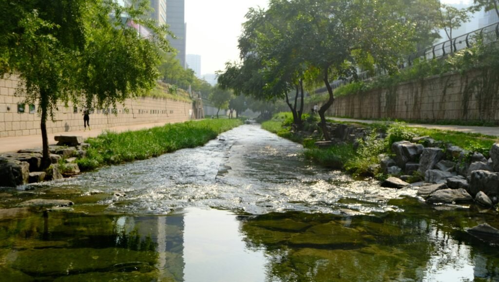
So the stream running through central Seoul isn’t just water following its natural course. What you see is part of a much larger urban water system operating behind the scenes.
It was never quite natural to begin with
That raises another question.
Before Cheonggyecheon was covered, was the original stream simply a piece of untouched nature running through Seoul?
Not really.
During the Joseon dynasty, the stream was called Gaecheon. It was a geoncheon, or dry stream: there was often very little water during normal weather, but heavy rain could make it rise quickly and flood.
Managing that water was important enough that the government installed a water gauge called the Supyo beside the old Supyo Bridge. Officials regularly measured the water level and reported it to the king. The Seoul Facilities Corporation’s history of the Supyo and Supyo Bridge explains how the gauge was used to monitor normal and dangerous water levels.
The stream itself was never simply left alone, either.
In 1412, King Taejong established a dedicated agency called the Gaecheon Dogam and mobilized 52,800 laborers to widen the streambed, reinforce its banks and improve bridges along the waterway. The name Gaecheon, meaning roughly “opened stream,” came to refer to the stream after this large-scale project. The official history of Cheonggyecheon from Seoul Facilities Corporation documents the project in detail.
Then, in 1760, after centuries of sediment had raised parts of the streambed almost to the level of the surrounding ground, King Yeongjo created another agency, the Juncheonsa, and mobilized roughly 200,000 people for a major dredging operation. The official account of King Yeongjo’s dredging project records the scale of the work.
Seoul has been managing this waterway for around six hundred years.
The story was never really nature versus something artificial. What changed was Seoul’s idea of what a good urban stream should be.
There was a time when covering it up was progress
Looking at Cheonggyecheon today, it’s easy to wonder why anyone would ever want to cover a stream in concrete.
But the Cheonggyecheon of the 1950s looked very different.
Makeshift housing crowded its banks after the Korean War. Sanitation infrastructure was inadequate, sewage and waste were serious problems, and flooding remained a concern.
At the time, covering the stream looked like a modern solution to several problems at once: sanitation, urban redevelopment and traffic.
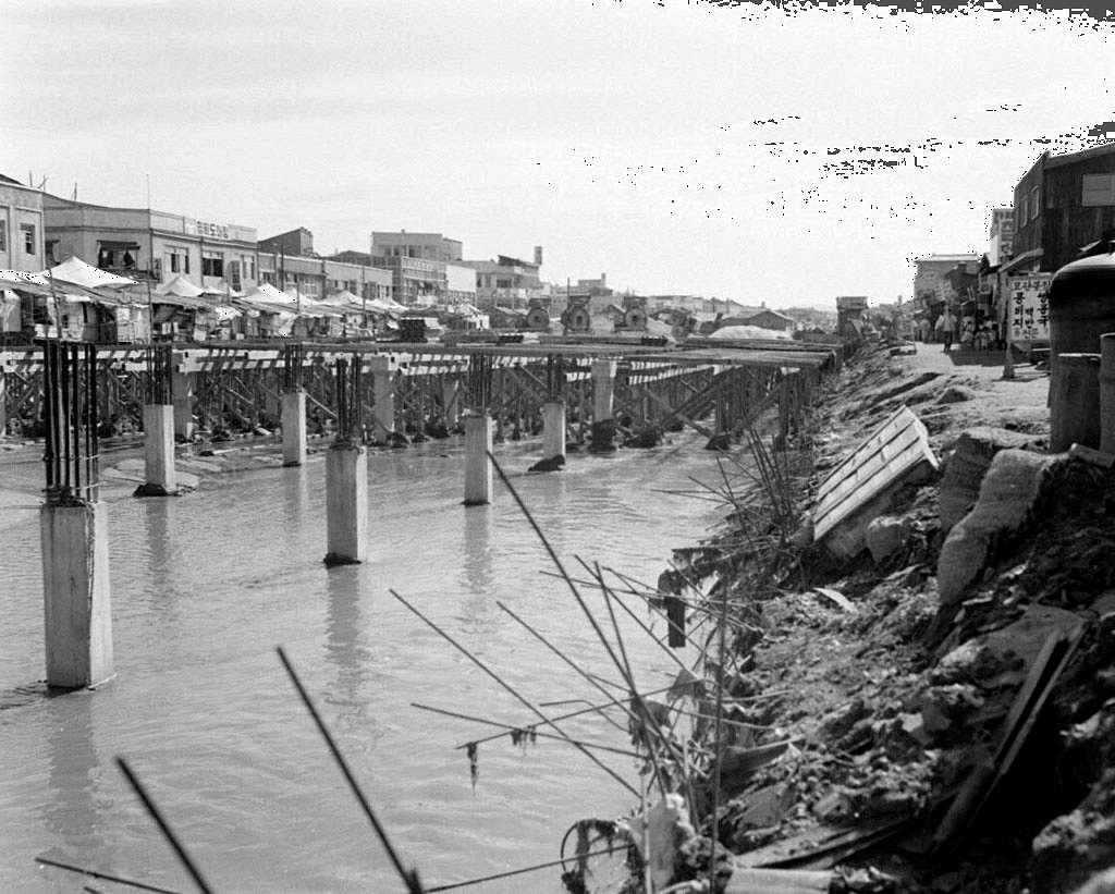
Large-scale covering work began in 1958 and continued section by section into the 1970s. Above the covered channel, construction of the Cheonggye Overpass began in 1967 and was completed in 1971.
Today that may sound like the opposite of good urban planning. Back then, it represented something very different. Seoul’s own materials describe the overpass as a symbol of South Korea’s rapid growth and modernization.
Modern Seoul, at that moment, meant covering the stream and putting a road above it.
That version of progress also came with a human cost.
According to the Seoul Metropolitan Archives’ history of Cheonggyecheon, homes along the stream were demolished during the covering project, and many residents were forcibly relocated to areas including Bongcheon-dong, Sillim-dong, Sanggye-dong and Gwangju Daedanji, which is now part of Seongnam.
Then progress reversed itself
A few decades later, the meaning of progress changed again.
Between July 2003 and September 2005, Seoul spent about 386.7 billion KRW removing the elevated road and reopening a 5.84-kilometer section of Cheonggyecheon. Those figures come from the Seoul Facilities Corporation’s official restoration project record.
The structure that had once represented modernization was now being removed in the name of another kind of modernization.
The restoration wasn’t free of conflict either.
Merchants and street vendors around the area faced relocation, and the city developed relocation measures that included the Garden5 commercial complex. Years later, SH Corporation described parts of the Garden5 relocation policy for former Cheonggyecheon merchants as a policy failure.
The interesting part isn’t simply that Seoul changed its mind.
It’s that both decisions were once presented as answers to the same basic question: what should a modern city look like?
So what are you actually looking at?
Cheonggyecheon is neither simply a triumph of nature over concrete nor just an artificial canal.
It follows a historic waterway that Seoul has managed and reshaped for centuries. The water you see today is actively supplied and maintained. The banks are engineered. The surrounding city has been rebuilt around it more than once.
Cheonggyecheon is the latest answer to a question Seoul has been asking for six hundred years:
What should a good urban stream be?
What to notice when you walk it
Once you know the history, a few things along Cheonggyecheon start to look different.
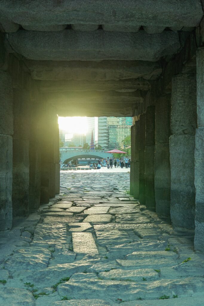
The preserved overpass piers
Between Biudang Bridge and Muhak Bridge, three columns from the old Cheonggye Overpass were deliberately left standing when the rest was removed.
Known today as Haneulmulteo, they were designated as part of Seoul Future Heritage and remain one of the clearest physical reminders that an elevated highway once ran above the stream.
The Seoul Metropolitan Government’s Future Heritage feature on the preserved piers explains why they were kept.
The historic Supyo site
The original Supyo Bridge was built during the Joseon period, and the water gauge beside it was used to monitor Cheonggyecheon’s rapidly changing water levels.
The historic stone bridge itself is no longer here. It was moved to Jangchungdan Park during the covering of Cheonggyecheon in 1959. The bridge you see along the restored stream today is not the original structure.
That makes the site more interesting, not less. It is another reminder that even the “restored” Cheonggyecheon is partly an interpretation of what used to be here.
Gwangtong Bridge
Gwangtong Bridge was one of the major crossings of old Seoul and stood on an important route through the Joseon capital.
Parts of the historic structure were discovered during the restoration project, but restoring every old bridge exactly where and how it originally stood proved impossible. Seoul’s official record of the historical and cultural restoration work documents the debate over how structures such as Gwangtong Bridge and Supyo Bridge should be handled.
That tension is part of the Cheonggyecheon story too: restoration doesn’t always mean putting history back exactly as it was.
The water beside you
Finally, look at the stream itself.
The steady flow, maintained banks and carefully designed public space can feel natural once you’ve been walking beside them for a while.
But they’re also a visible reminder that today’s Cheonggyecheon is a carefully managed piece of urban infrastructure built around a much older waterway.
And in some ways, that’s the whole story.
Seoul didn’t simply destroy a natural stream and then bring it back.
For centuries, it has kept changing the stream to match whatever the city believed it needed at the time.
From here, you can keep walking east toward Gwangjang Market and Dongdaemun, or leave the stream around Euljiro and explore the streets above it.